A City of Boston Cyclist Safety Report examines bicycle crashes reported to police and emergency medical services in the years 2009 through 2012.
This page is a supporting document for my blog post about the Western Avenue Cycle Track, and reveals inconsistencies between the Report and actual conditions on Western Avenue during the reporting period.
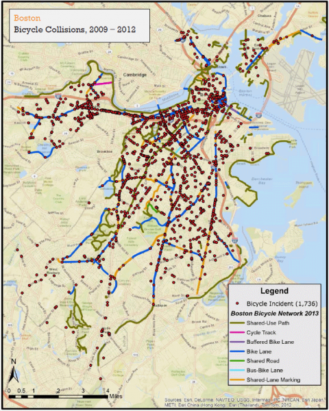
The magenta line in the upper left of the image below indicates that a cycle track — a bikeway behind a row of parked cars — was installed on a segment of Western Avenue.
Glancing at the map, from page 62 of the report, you would gain the impression that there was a cycle track over the full 0.58 mile length of Western Avenue between North Harvard Street and Soldiers Field Road throughout the time period of the study, 2009-2012.
The legend at the lower right indicates however, that the Boston Bicycle Network data are from after the end of the study period, in 2013. Also, my research shows that while total mileage-years for the segment, counting each direction of travel separately, are 4.6 (0.58 * 4 * 2), only at most 0.2 mile of cycle track, on one side of the street, existed at any time from 2009-2012 — and the cycle track mileage * years 2009-2012 amount to only 5.4% of the total for the 0.58 mile segment. In 2013, the cycle track still amounted to only 0.2 mile on one side of the street.
This map, based on police data, shows no crashes for the 0.58 mile segment of Western Avenue.
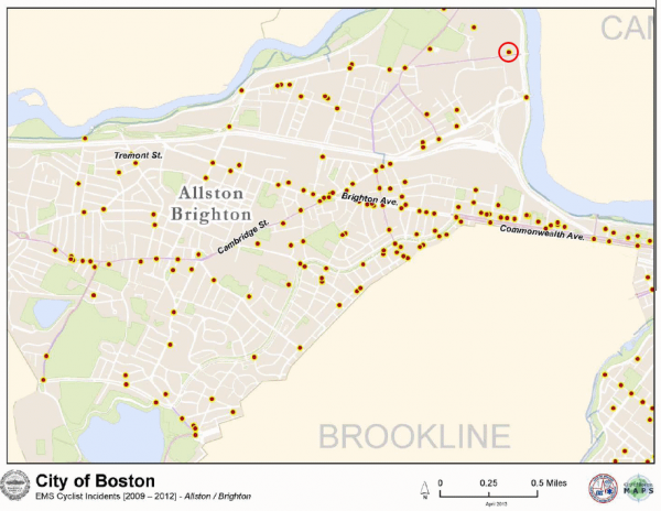
A separate part of the report covers crashes which reulsted in an EMT call. One crash on the Western Avenue segment resultedin an EMT call, as shown on page 88 of the report and circled in the image below. Most bicycle crashes result in neither a police call nor an EMT call, so there were almost certainly other crashes.


