This is a supporting document for my blog post about Boston’s Western Avenue cycle track.
You would think that a prominent proponent of cycle tracks and author/co-author of several research studies about them would have accurate information about the first one constructed in her home city, one which she herself was instrumental in promoting. Prepare to be surprised.
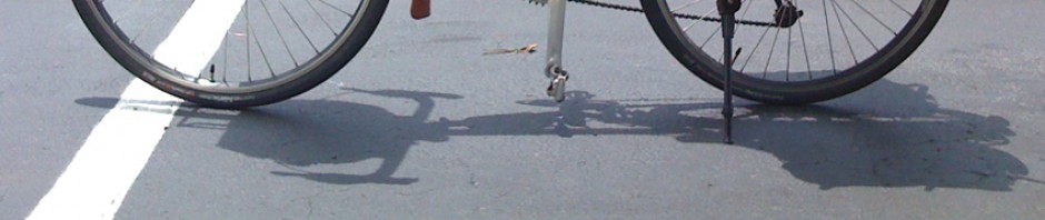
Just to get the record straight from the start, the Western Avenue Cycle track was constructed between November, 2010 and mid to late 2012: that is, 1 1/2 to 3 1/2 years before the e-mail correspondence reported below. Neither was it crash-free, as my blog post reports.
On June 14, 2014, I e-mailed Anne Lusk, Visiting Scientist at the Harvard School of Public health, who has authored and co-authored several research papers about cycle tracks:
Anne —
The transcript of the April 10 meeting about the Allston-Brighton Turnpike straightening (and we hope, much more) project,
records you as having offered the following comments:
Ann Lusk (AL): Ann Lusk at the Harvard School of Public Health. I’ve worked on bicycle environments for 32 years. I’ve been in Boston for about 11 years now and 11 years ago we started the research on cycle tracks. Cycle tracks are barrier protected, bicycle exclusive paths. Back then nobody knew what they were and we did not have many bicyclists in the Boston area. President Summers had proposed the huge expansion of the Harvard, Allston/Brighton campus and there were no cycle tracks so we studied those plans and we worked with Mike McBride, the engineer with the Harvard, Allston/Brighton design team. We even invited Mike to come to the design charrette classes that I held as part of a bicycle in the environment class. Mike then worked with the Harvard, Allston/Brighton design team and designed the Western Avenue cycle track. If you look at the data for the City of Boston for crashes, that is the safest bicycle environmental in the entire City of Boston. That was 21 years ago. We at the Harvard School of Public Health would love to also give you all of our continued research because we know you’re going to build this in 2017. As we look into the future, we can also look into the past and we would call this an “Emerald Necklace Bicycle Path,” because the bicycle was invented before the car. Overlay onto that a “Climate Change Cycle Track,” that is the new concept. It’s a sidewalk without trees because we want it to have ADA accessibility and trees in tree pits do not typically do well. It has a permeable surface. It is a wide cycle track, a social cycle track where people can bicycle side-by-side. The water goes through the permeable surface and then waters a vegetation corridor which is parallel to the cycle track between the cars. This water will feed to the plants and help keep a vegetated buffer that will reduce toxins breathed in by the cyclist. Also on the Climate Change Cycle Track there is going to be lighting that will be solar lighting with outlets so you can charge your smart phone or a battery. Please look to us we’d love to give you all our research.
Could you please:
- confirm whether this is an accurate transcription of what you said, or at least of what you meant?
- identify and give more detail about the data you cited in your statement, “Mike then worked with the Harvard, Allston/Brighton design team and designed the Western Avenue cycle track. If you look at the data for the City of Boston for crashes, that is the safest bicycle environment[al] in the entire City of Boston.”
My impression is that there are few bicycle crashes there, but there is also light bicycle traffic. Also, the cycle track exists for only about 1/3 of the stretch between North Harvard Street and Soldiers Field Road, and only eastbound. Did the data collection distinguish between eastbound and westbound traffic, cycle track and bike lane segments, and did it measure use rates?
Thanks!
On June 16, Lusk replied:
John,
Thanks for sending the comments. I can’t believe someone actually typed up all that we said. The only change in what I said is the Western Avenue cycle track was built about 5 years ago, I believe (not 21 years ago). If you look at the map of the crash locations for the City of Boston, there is a pink line that shows the cycle track and that there have been no crashes on Western Avenue. Yes, there is a bike lane on the other side so I guess we can assume there have also not been crashes on the bike lane. Yes, there is low traffic on that section of Western Avenue but we don’t have many cycle tracks in the Boston area for a comparison. I do still believe that is the safest place to bicycle in all of Boston if you looked at the colored lines. See pages 62 and 66 for the pink line on Western Avenue for the cycle track. http://www.cityofboston.gov/news/uploads/16776_49_15_27.pdf
I don’t believe that measurement included rate. I think the City of Boston only counted crashes. Still, the rate with the counts would still come to zero because there were zero crashes indicted.
Thanks again,
Anne
I responded on June 17:
Anne, thanks for your response. I have another couple of questions —
You say “we studied those plans” [for the Harvard expansion]. Who were the “we”? — not only you, but other researchers at HSPH?
Who was Michael McBride working for at the time you worked with him — Harvard, or HDR. (I see both in his LinkedIn profile).
What documentation do you point to on the Climate Change Cycle Track? (online, I hope).
Thanks again.
Lusk replied on the same day:
John,
You ask good questions. You will remember that President Larry Summers was going to build a huge new campus for Harvard in Allston. He had the Harvard Allston/Brighton Design Team (they were on the top floor of Holyoke Center and comprised of architects and engineers) write up a full proposal about how to design that new campus. The campus plans had no bicycle facilities except perhaps a few shared-use paths that went through the campus. Jack Spengler, Ph.D. who is a Professor in Environmental Health, gave me a copy of the plan and asked me to critique it. I also showed it to Walter Willett, MD, Dr. P.H. who is my boss and a bicyclist. I wrote a critique of it and sent it to the designers of the Harvard Allston campus but still received push back. The engineers for the campus, who had hired John Ciccarelli, said that cycle tracks were less safe based on the research of William Moritz. Then, Walter Willett suggested I study the research of William Moritz and our articles about cycle tracks were started. I worked with Peter Furth to make suggestions based on the plans for the Harvard Allston campus and did new drawings for the roads. The new plans were forwarded by Walter Willett to President Faust, the new President of Harvard, and signed by 14 faculty and other individuals from Harvard. I was invited to make a presentation about cycle tracks to the individuals of the Harvard Allston/Brighton design team, of which Mike McBride was their engineer. I stayed in contact with Mike and asked him to do design charrettes in my HSPH and Harvard Extension bicycle classes. The students, one of which was Pete Stidman, drew cycle tracks on the trace overlay that we placed on the aerial views of the streets on the Harvard Allston campus. Then, Mike started working with the City of Boston and proposed the cycle track on Western Avenue. I wasn’t part of those meetings with the City of Boston but by this time the Harvard Allston/Brighton Design team had seen the wisdom of putting in the cycle tracks instead of bike lanes in the door zones. Thus, when I describe “we” it was a large collective “we” of many people associated with Harvard who were involved in asking for that cycle track. Mike McBride is no longer with the Harvard Allston/Brighton Design team because that design group was disbanded. Now, I’m not sure who is designing that section of the Harvard campus.
The Climate Change Cycle Track is a new concept that I developed by putting together all the necessary elements for lowering climate change (less driving, more trees, permeable surface, bioswales, etc. I just presented the research at the International Making Cities Livable conference in Portland, Oregon last week. I haven’t yet published the research and am working on finding grant money about lowering mobile source air pollution with the plantings in the bioswales. I am finalizing an article about preferences of tree and bush placement in association with cycle tracks.
Hope this helps and keep up your good work… I am a fan and have often looked at your web sites with all the pictures of other environments!
Anne
I responded on the 18th:
Anne — Thanks for your detailed reply.
In the interest of accurate history, I am still trying to establish the date of installation of the cycle track. That has proved to be a vexing problem. I have two dates, completely in disagreement with each other, and both documented with video!
In my video shot on June 7, 2012 (Thursday of reunion week at MIT — I was returning from Cambridge where I shot video of the traffic jam with the buses to take alumni to the MIT Pops concert), there is very clearly no cycle track. The occasion is obvious from the traffic jam, and I have confirmed the year as date-stamped by my GoPro Camera by checking the license plate sticker site http://www.andrewturnbull.net/plates/sticker.html. Green was 2012 expiration, red 2013. It checks. I’ve put the Soldiers Field Road-North Harvard Street segment of the video online for your review at https://www.youtube.com/watch?v=_ozoR53poHM
But on the other hand, there is a blog post with a video dated November, 2010 showing the newly-installed cycle track! http://thehum.bostonbiker.org/2010/11/17/suv-loves-western-ave-s-new-bike-lane-as-much-as-i-do/
I’ve posted a comment asking the blogger what he can tell me. Unfortunately, his video isn’t sharp enough to reveal license-plate stickers.
I know that the cycle track was in place in the spring of 2013. Was it maybe installed, then removed, then installed again, or did we experience some kind of time warp?
I ride Western Avenue fairly often, as it is on the most direct route from Cambridge to Waltham, and it’s hard to imagine that I would not have noticed the cycle track!
Lusk responded, the same day:
John,
I know that the cycle track was installed in two phases. The first phase was simpler and shorter compared to what we have now. The cycle tracks were not in place in 2009 because that is when these articles were written.
http://www.boston.com/news/local/articles/2009/03/22/reevaluating_plans_for_harvard_held_land/
http://www.thecrimson.com/article/2009/3/16/allston-looks-for-creative-solutions-in/
This shows that somewhere around 2010 the cycle track was initially installed. It must have been expanded in 2011.
http://www.boston.com/yourtown/news/allston_brighton/2010/11/half-mile_stretch_of_western_a.html
Were you on the other side of the street and only saw the bike lane when you were shooting? There is still a section of Western Avenue near that Swiss bakery that doesn’t have a cycle track. I could also email Harry Mattison [an advocate for street improvements in the Brighton area of Boston] as he might know when it was installed. We can also ask Nicole [Freedman, Boston’s Bicycle Coordinator].
Yes, you would have noticed if a cycle track had been installed.
Anne
And, still on June 18, I solved the mystery using Google Street View:
Mystery mostly solved using Google Street View,
If you click on clock face at the upper left in the new version of Google Maps, you can open street views for different dates.
A section near the Harvard Business School was installed in November, 2010 as Greg Hum’s video shows, and with construction-zone barrels. Flex posts were installed in July or August 2011. This segment was removed sometime before June 2012 and reinstalled before October 2012. Remaining question is, why removed and then reinstalled? Was it an experiment? Was there a design revision?
The other section nearer North Harvard Street was not installed till sometime between July and October 2012:
They run those Google cars a lot. My son Jacob and I probably got recorded by one yesterday.
And on the 19th, Lusk responded:
Fascinating! I didn’t know that google had a clock. It says “New” beside it so it must be new. Thanks for telling me about that exciting tool. I use Google Street view all the time, sometimes getting dizzy while I “ride” streets too fast.
I only know that Mike McBride said they were going to “test” a cycle track before they permanently installed one. This might have also been caution on the part of the City of Boston because no cycle track had been built by the City. At that time, cycle tracks were still relatively unknown in the U.S. I don’t know if that was initial cycle track was an Experiment. After the Experiment proved safe, they then more permanently installed the cycle track. It certainly has proven to be the safest bicycle route in the city. I will agree with comments that you have made about cycle tracks earlier that if they are wide (similar to some in NYC) and they don’t have lots of cross streets, they can be safer.
Hope this helps,
Anne