Let’s look at how well bicycle routes around the Boston end of the Harvard Bridge (Massachusetts Avenue bridge over the Charles River) might be improved.
Here is a Google maps overview of the area. There are two special bicycle routes in the area: the Paul Dudley White bicycle path along the river, and the ramp from the path to the downstream sidewalk of the bridge (lower left in the picture). There are bike lanes on the bridge; bicyclists also ride on the sidewalks, and for some trips, have no alternative because the Paul Dudley White bicycle path on the Boston side connects only with the sidewalk on the downstream side of the bridge.
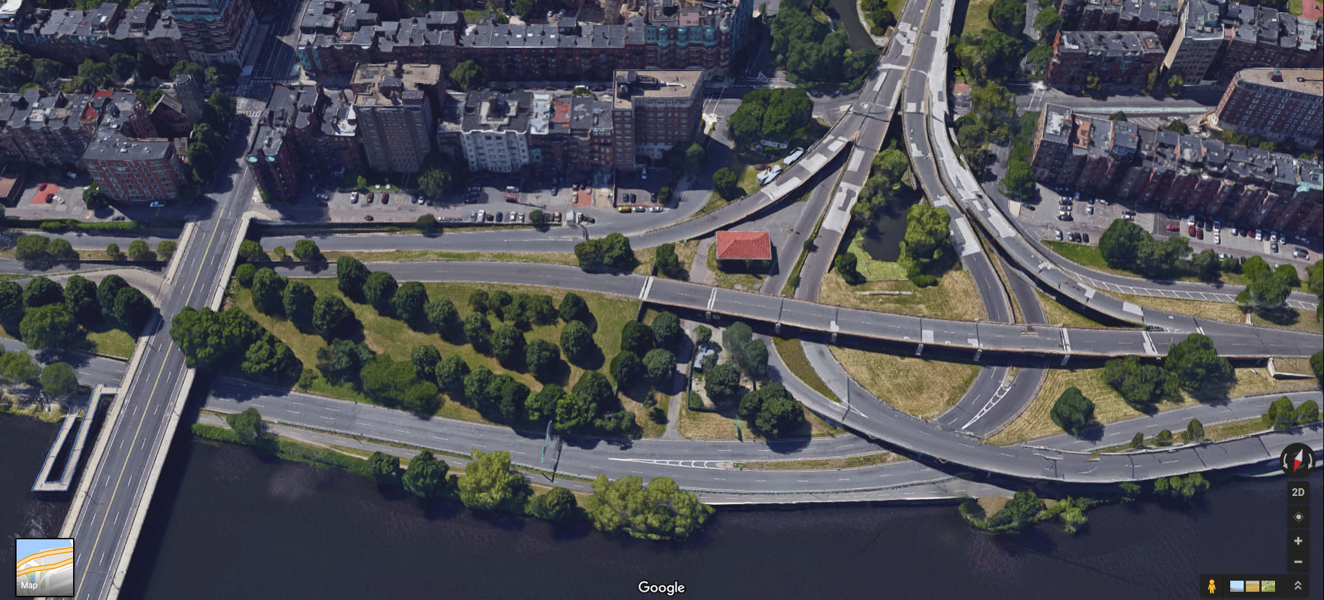
South end of the Harvard Bridge and Charlesgate as of 2017. Click on the image for a larger view.
Up to the 1980s, there was only a stairway up from the Paul Dudley White Bicycle Path to the sidewalk.
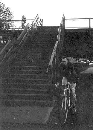
Stairs from the PDW path to the Harvard Bridge, Boston end, 1970s.
Bicyclists could carry their bicycles up and down the stairs, and able-bodied pedestrians could use the stairs too, but there was no wheelchair access. Bicyclists headed toward Boston had to travel opposite traffic until they could cross Massachusetts Avenue. Bicyclists headed for Cambridge could ride on the narrow sidewalk until they reached the Cambridge end of the bridge; similarly, but in the opposite directions, for people headed to the path.
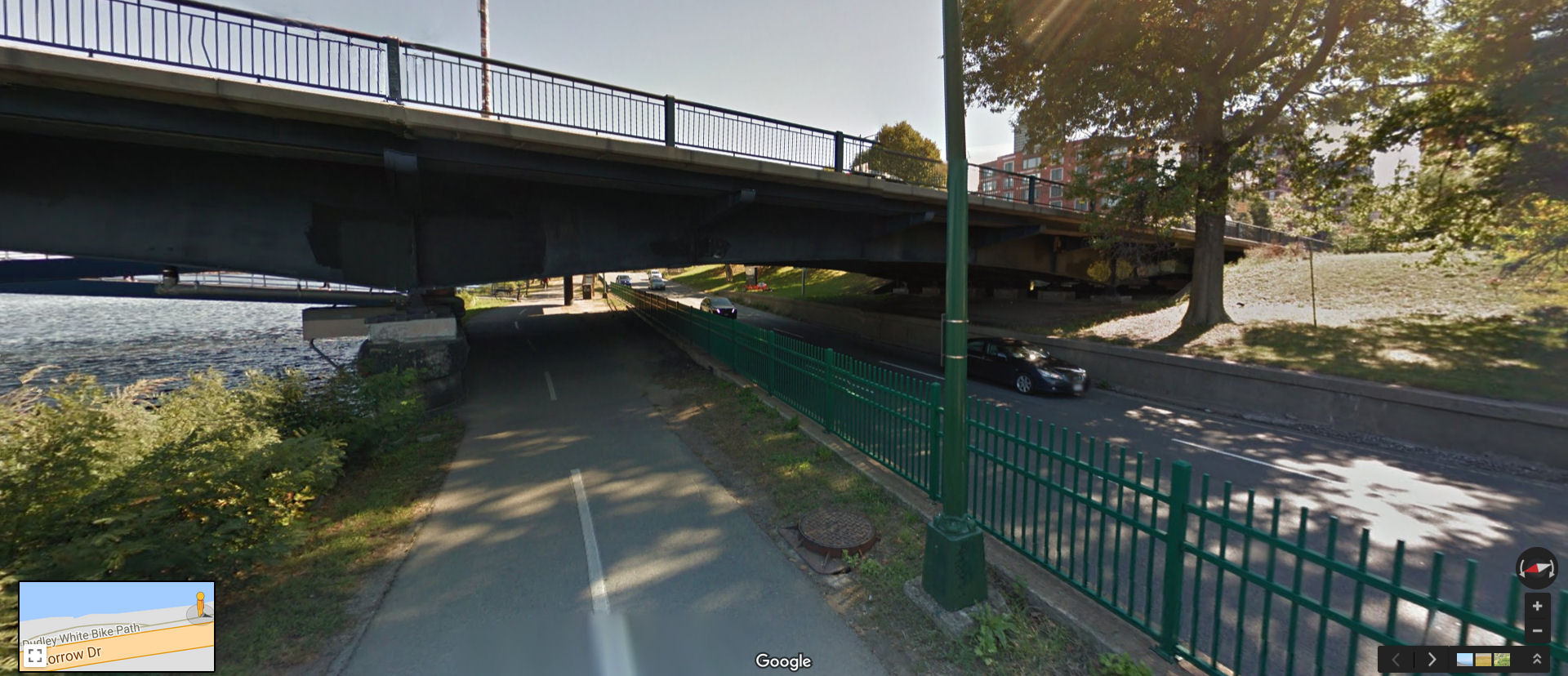
When the Harvard Bridge was reconstructed in the late 1980s, a ramp up to the sidewalk replaced the stairs, providing wheelchair access. Bicyclists could now ride their bicycles to and from the downstream sidewalk, too.
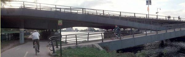
Ramp between the PDW path and Harvard Bridge, Boston.
Crossing from the upstream side of the bridge still required going to the crosswalk at Beacon Street, as I described in an earlier post:
Currently, there is no way to get down to the Paul Dudley White path along the riverfront on the upstream side of the bridge. This leads to bicyclists’ riding down to Beacon Street and then cutting across in the near-side crosswalk so they can use the ramp on the downstream side, resulting in additional delay and risk. There is an example of this in my video. Dr. Peter Furth has pointed out that there is inaccessible parkland just upriver from the Harvard Bridge. Comprehensive improvements would both make the path accessible and provide access to this parkland. Easy access to the path and to Back Street, on the inland side of Storrow Drive, would allow bicyclists to continue their trips on streets which are less troublesome than Massachusetts Avenue.
The route which bicyclists take from the bridge to the path is shown as the red line near the left side of the image below. I frequently see bicyclists taking this route.
Route from Cambridge to the PDW path on the Boston side. Click on the image for a larger view.
The only other alternative to the route shown is to ride on the downstream sidewalk, and that can involve delay and hazards at the Cambridge end of the bridge.
There really needs to be a ramp on the upstream side as well — here.
Boston end of the Harvard bridge, seen from the west. Click on the image for a larger view.
Notice that the ground slopes up almost to the level of the bridge deck at the right side of the image. Over Storrow Drive and the path, the bridge structure extends well below the bridge deck. These conditions allow for a ramp which connects with the bridge on solid ground, and extends less far over the water than the existing ramp. The proposed ramp is shown at A in the image below.
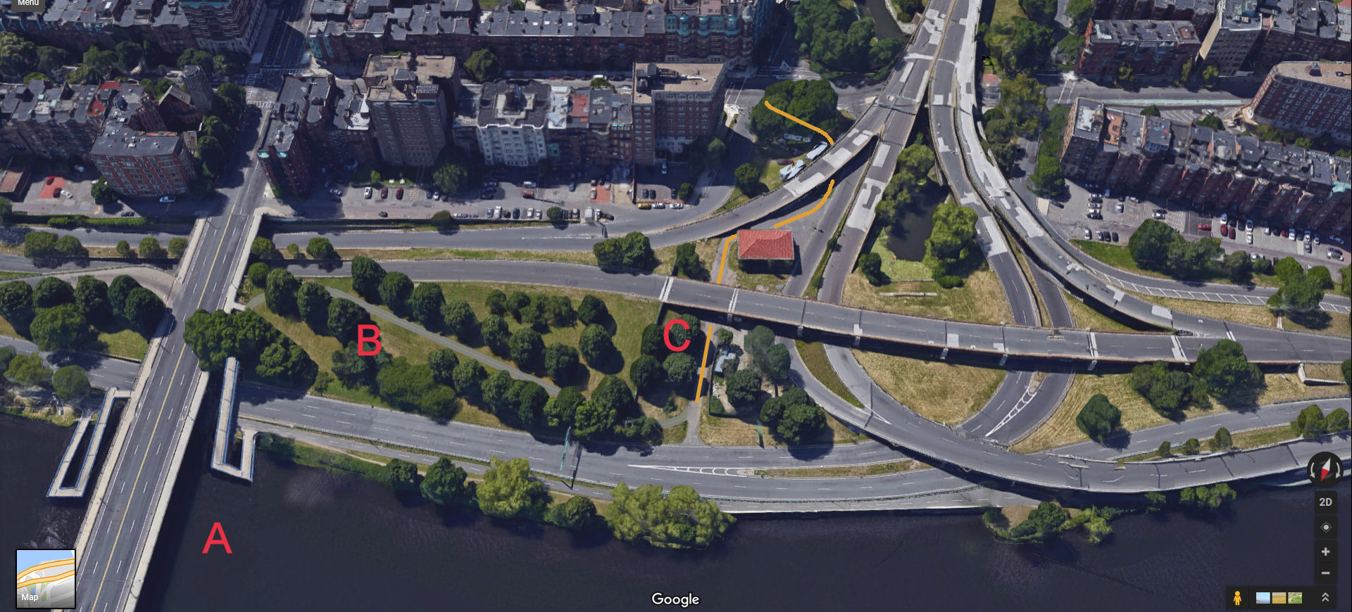
Making connections. Click for a larger view.
Connecting the ramp to the bridge on solid ground offers another benefit. A new path (at B in the image) can connect from the bridge to parkland which is presently inaccessible from Massachusetts Avenue. As I already mentioned, this possibility has been suggested before, by Dr. Peter Furth, in connection with a proposal to improve bicycle access over the Bowker overpass, (shown at the top right in the image). A similar proposal is described on the Web site of the Charlesgate Alliance, probably reflecting input from Dr. Furth. I developed my proposal entirely independently before discovering the materials on the Charlesgate Alliance site, and the routing of the paths is nearly identical. The Charlesgate Alliance proposal does not include a ramp on the upstream side of the bridge. Instead, that proposal includes a new crosswalk across the bridge. Traffic is either fast here, or backed up from the traffic light at Beacon Street. I regard a crosswalk as a cheap and unsatisfactory alternative. Is the goal to make bicycle and pedestrian travel safer and more convenient, or to create an obstacle course for motorists?
I have shown a T intersection between the ramp and the new path. A roundabout might allow for smoother traffic flow. I have also shown curb cuts so bicyclists could move between the sidewalks and bike lanes.
The Bowker overpass is one of the great travesties of road construction in the Boston area, burying Olmsted parkland under concrete, and in poor repair (note all the patches) but that is a story for another place. Be it as it may, the parkland is accessible from the Bowker Overpass end by a route shown with an orange line at C in the image above. Here are some Google Street View images from points along that route.

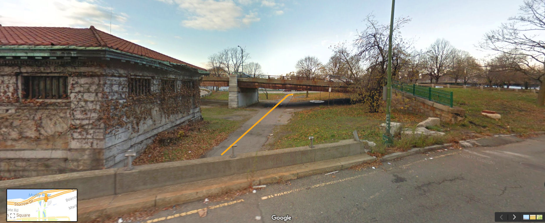
Bowker overpass end of connection to parkland
The image above is from the Bowker overpass and shows how a connecting path could pass from Beacon Street under a ramp to Storrow Drive eastbound (right side of image), and then connect with an existing driveway which is used only occasionally by maintenance and emergency vehicles.
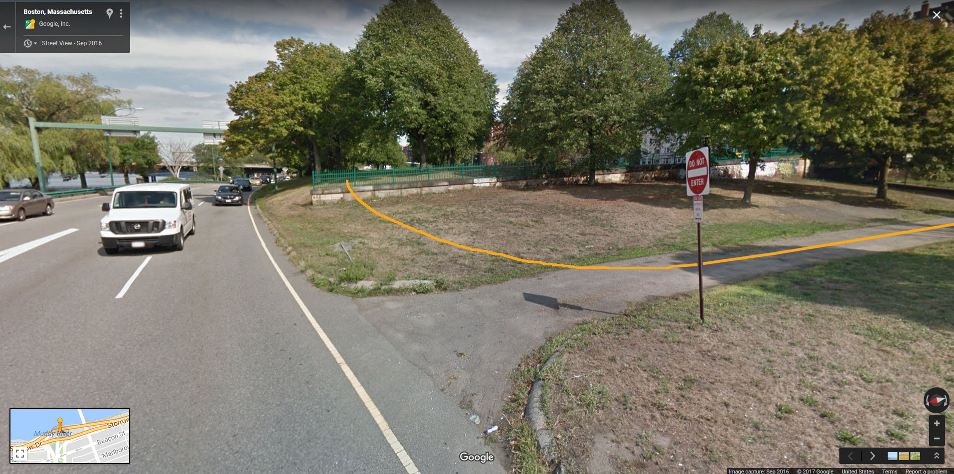
Continuation of route to parkland
The route continues around the building also seen in the previous photo and under the eastbound lanes of Storrow Drive. Then the route turns and goes uphill toward Massachusetts Avenue.
Connection between service road and proposed path to Massachusetts Avenue.
Lawn-mowing equipment passes around the end of the wall in the image above. A few feet of the wall should be removed (or the path elevated) for more clearance from the roadway.
The ramp to the path is an engineering project of the same order as the existing ramp. Making the remainder of the connection would require paving only about 500 feet of path, and signage.
