The Boston University campus is, let’s face it, a strip mall with classrooms. Commonwealth Avenue is the only way to get from one end of the campus to the other.
Following the tragic death last December of Boston University student Chris Weigl, various suggestions have been made for how to improve Commonwealth Avenue. Here is one, in a quote from a news report:
Biking has been growing rapidly, but most people in Boston are still too scared to bike,” said Jessica Robertson, Transportation Coordinator for the Metropolitan Area Planning Council. “The city must install more cycle tracks and bike lanes with physical separation from traffic.”
Not! Weigl was riding downhill, reportedly at a high speed, eastbound toward St. Paul Street. There is already a bike lane — in the door zone — leading to the location of his crash. Weigl was riding in the bike lane, to the right of stopped and slow traffic in the next lane. That was highly hazardous because of the car doors and also would put him out of view of the mirrors of the trucker who killed him with a wide right turn, and would decrease his maneuvering room to swerve out of the way.
Now, just imagine a cyclist riding down that same hill, at that same speed, except in a separated bikeway, trapped behind a barrier or hidden behind a row of parked cars. That would improve safety? No, it would be just the same. Or, oh, cyclists should slow down. I’ve heard that one lately. This reminds me of the story of Goldilocks and the Three Bears: it used to be that cyclists are too slow…so, get us off the street, build a third-rate bikeway for us, and then we are too fast. Problem is, slow cycling shrinks cyclists’ horizons, doesn’t cut it as physical exercise, and is No Fun At All for cyclists who ride regularly and are physically fit. Cyclists just won’t do it. Except uphill, of course, but rides can’t be entirely uphill.
If cyclists are going to ride on Commonwealth Avenue, the safest option is to follow the normal rules of the road. If riding at motorcycle speed, like Weigl, take the advice given to motorcyclists — control the travel lane, to be more visible and have more maneuvering room. That’s what I do, and I’ve been riding Commonwealth Avenue problem-free, for decades.
Now, please don’t accuse me of catering only to the supposed 1% of cyclists who are described as “strong and fearless” by facilities advocates. Actually, the number was pulled out of a hat. In reality, it varies among different populations.
And, neither are all the fearless strong, nor the strong, fearless. Fearlessness typically reflects skill, rather than daring. But I digress.
Timid and inexperienced cyclists, and pedestrians, really ought not have to use Commonwealth Avenue to get around the BU campus.
Let me make a few suggestions for improvements:
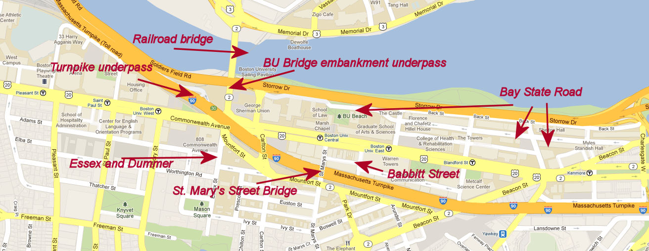
- Restore the section of the Claire Saltonstall Bikeway (Boston to Cape route) which passes through the campus (Silber Way, Blandford Street, Cummington Mall, Babbitt Street). BU dismantled this route by gating off Babbitt Street!
- Install a contraflow bike lane on St. Mary’s Street, to provide an alternative to the Mountfort Street/Carlton Street/Commonwealth Avenue tangle for access between the campus and neighborhoods south of the Turnpike, and to complete the two-way back-street connection for the Claire Saltonstall bikeway.
- Install a contraflow bike lane on Essex Street for easy access from the BU bridge into the residential neighborhoods south of Commonwealth Avenue. [Update: this has been done as of March, 2014, though there are some serious design issues with the treatment. I have another post on this blog about this intersection.]
- Reconfigure additional streets for better bicycle access. For example, make Bay State Road into a two-way bicycle boulevard (allowing local access, but designed to discourage through motor vehicle travel).
- Link the two ends of the campus with a pathway that goes under the BU Bridge embankment and the Turnpike. There are already underpasses here. The only serious engineering challenge is to construct an overpass or tunnel at Boston-Worcester rail line which parallels the Turnpike.
- Connect this pathway across the Charles River using the unused half of the Grand Junction railroad bridge which runs under the BU Bridge.
The locations are shown on this map. You may click on it to enlarge it and get a clearer view.
Here are some photos illustrating these possibilities:
Path under the BU Bridge embankment next to Soldiers Field Road. With some improvements — widening, repaving a barrier between it and the roadway, lighting — this path could be an attractive bicycle and pedestrian route. (photo from Google Street View).
The bridge in the background is a two-track railroad bridge, but only one track is in use. The unused half of the bridge could make an attractive path connection to the Paul Dudley White path on both sides of the Charles River, and under Memorial Drive into Cambridgeport. I’ve been campaigning for that since before 1980 — see this Web page. Hope springs eternal.

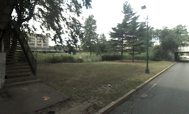
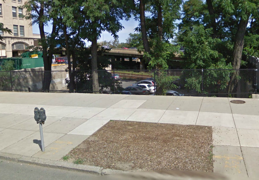
Path paralleling Soldiers Field Road leads only to stairs and a fenced enclosure at the upstream side of the BU Bridge (photo from Google Street View)
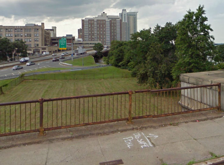
East end of underpass under the Turnpike as seen from the BU Bridge. Note the fenced enclosure (mowed area in the foreground) (photo from Google Street View)
West end of underpass under the Turnpike. Note that it is possible to see all the way across under the Turnpike. (photo from Google Street View)
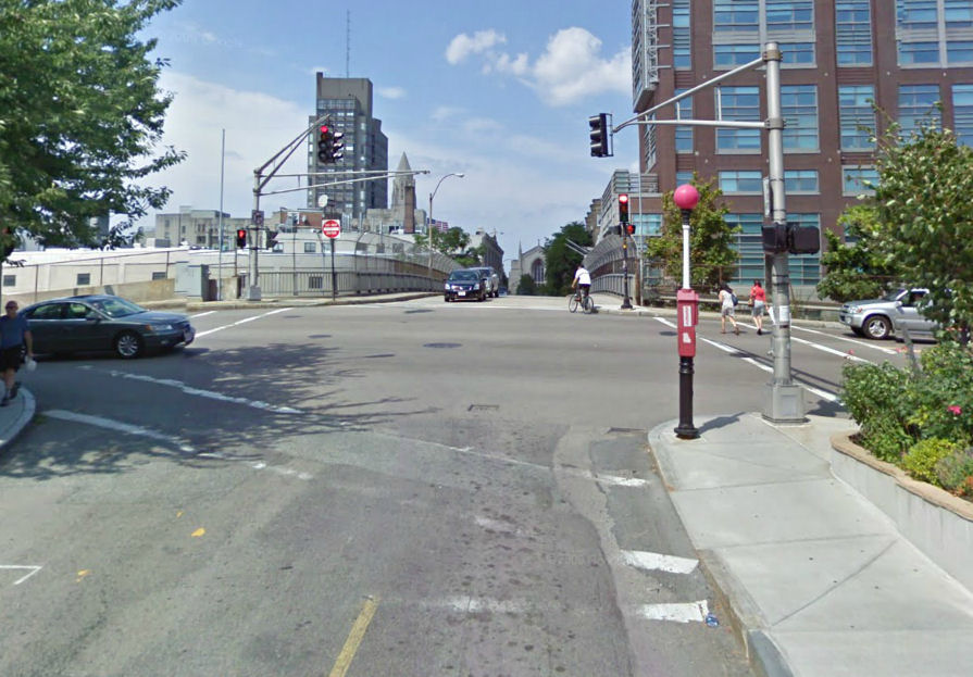
Essex Street one-way at Dummer Street. How much, well, Dummer than this is it possible to get? (photo from Google Street View) [Update: contraflow bicycle travel is now permitted here, though there are design issues. I have another post which tracks the history of this intersection up through 2019.]
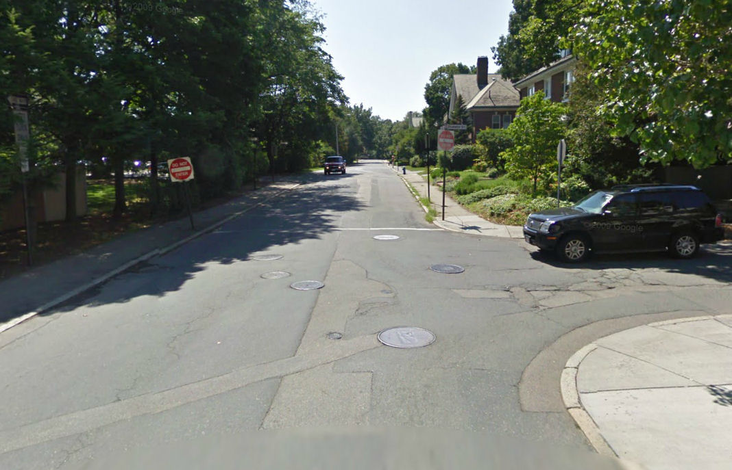
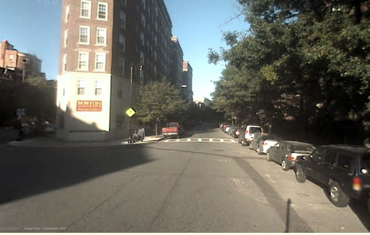
St. Mary Street bridge over the Turnpike, looking north toward Commonwealth Avenue. The BU chapel is visible in the background. The cyclist is entering the bridge in the contraflow direction. This ought to be legal, with a designated contraflow bike lane. (photo from Google Street View)
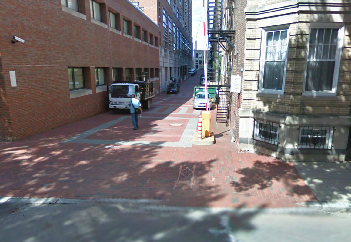
Babbitt Street, seen from Cummington Mall — BU’s gated community. How often is the gate open? I don’t know. The building in the background is on St. Mary’s Street. (photo from Google Street View).
Also see the Claire Saltonstall Bikeway map on the masspaths.org site. The tricky northbound routing on Mountfort Street would be unnecessary with a contraflow lane on St. Mary Street, and reopening of Babbitt Street.
Entrance to Bay State Road from Beacon Street. Bay State Road runs one block north of Commonwealth Avenue. Many BU dormitories are along Bay State Road, which carries very light traffic. Instead of being one-way, it should be configured as a two-way bicycle boulevard, allowing only local access by motorists. (photo from Google Street View)
Yet more such possibilities might suggest themselves if attention is focused in this direction.
For decades, Boston University has neglected the problems with its strip-mall campus. Now with Hubway stations and the bike lanes along Commonwealth Avenue, and the BU Bridge improvements, perhaps the BU administration thinks, problem solved. Not so. Let’s get on with it.
